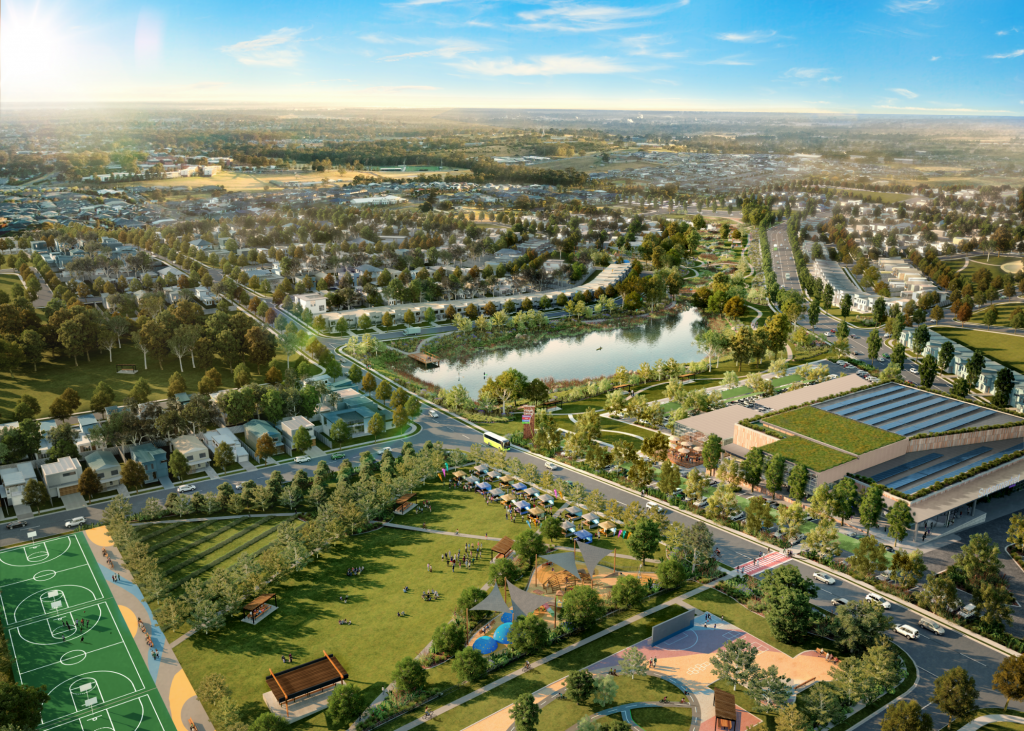
VISUALISATION is the art of bringing technical plans to life in a way that gets everybody on the same page.
Our team can help you to visualise and enhance the identity of a future place by translating complex planning and design information into clear, beautiful visual outputs so that nothing is lost in translation. We understand the need for audiences to connect and engage with the vision and design at the early stage of the project, to ensure the return on investment.
Our in-house 3D artists and designers deliver industry specific content through the production of geospatial mapping, 3D modelling, visual impact montage, 3D rendering, fly through animation, interactive and innovative tools. We have a collaborative approach to project process, with an integrated design process that gets to the heart of the project’s needs to deliver targeted and memorable outputs. We use a range of industry leading programs and platforms to deliver the vision and with the combined insights of the Strategic Communications team, we can create an integrated and innovative strategy for every project.
services
3D Render Images
Photo Montage Images
Conceptual 3D Graphics
Visual Impact Assessment Images
3D Fly Through Animations
Innovations
VR 360 Tours
Interactive online Tools
our points of difference
Place design group uses a range of industry leading programs and platforms to deliver your vision, including Autodesk 3ds Max for 3D modelling and animation along with Vray for rendering. AutoCAD and Global Mapper are used for geospatial 3D processing, and the Adobe Creative Cloud suite is used in post production.
1
Inception
To kick things off, a meeting is set up with the client to discuss the project and desired deliverables. The target audience, mood and message of the visualisation and animation is determined along with view angles and flight paths. All information, CAD drawings and models of the project available is gathered up in preparation for building the 3D scenes. If background context photography or video is needed, this is also discussed, and views and paths determined.
2
Creating the 3D Scenes
We then develop the 3D modelling of the 3D scene with topology using CAD and pdf information supplied. Camaras are added and views are set up, including landscape planting, trees, people, and cars, as well as any other scene specific details. Materials and finishes are created per the projects schedule and lighting is fine tuned. Draft camera views for stills and flight paths for animations are produced for sign off.
3
Rendering and Post-Production
High-quality, high-resolution renders and render passes are created and combined in Photoshop (for stills) and After Effects (for animations) to enhance the overall quality of the image. The passes are extra rendered layers of the scene that help enhance materiality, lighting, shadows and reflections. If context photography or video is being used for the scene, it will be seamlessly integrated with the scene as well.
360 VR tours are also generated using 3D models encased within a 360° spherical photographic environment. Still scenes are then rendered by a spherical camera in the 3D software and strung together in a 360° spherical tour. These tours can be explored on your phone or computer screen, but really impress when viewed through VR goggles!